
Guam Government House 🇬🇺
-
Nautical Twilight begins:05:24 amSunrise:06:09 am
-
Sunset:06:22 pmNautical Twilight ends:07:07 pm
-
Moonrise:01:52 am
-
Moonset:03:11 pm
-
Moon over:08:31 am
-
Moon under:09:00 pm
-
Visibility:22%
-
 Waning Crescent
-
Distance to earth:375,907 kmProximity:69.9 %
Moon Phases for Guam Government House
-
good Day
-
minor Time:12:52 am - 02:52 am
-
major Time:07:31 am - 09:31 am
-
minor Time:02:11 pm - 04:11 pm
-
major Time:08:00 pm - 10:00 pm
Tide Clock
Tide Graph
Times
| Tide | Time | Height |
|---|---|---|
| high | 01:34 am | 1.67 ft |
| low | 09:35 am | -0.23 ft |
| high | 05:23 pm | 1.67 ft |
| low | 10:13 pm | 1.25 ft |
| Date | Major Bite Times | Minor Bite Times | Sun | Moon | Moonphase | Tide Times |
|---|---|---|---|---|---|---|
|
Wed, 17 Sep
|
07:31 am -
09:31 am
08:00 pm -
10:00 pm
|
12:52 am -
02:52 am
02:11 pm -
04:11 pm
|
R: 06:09 am S: 06:22 pm |
R: 01:52 am S: 03:11 pm |
Waning Crescent |
high: 01:34 am
, 1.67 ft
, Coeff: 79
low: 09:35 am
, -0.23 ft
high: 05:23 pm
, 1.67 ft
, Coeff: 79
low: 10:13 pm
, 1.25 ft
|
|
Thu, 18 Sep
|
08:24 am -
10:24 am
08:52 pm -
10:52 pm
|
01:50 am -
03:50 am
02:58 pm -
04:58 pm
|
R: 06:09 am S: 06:21 pm |
R: 02:50 am S: 03:58 pm |
Waning Crescent |
high: 02:49 am
, 1.67 ft
, Coeff: 79
low: 10:32 am
, -0.13 ft
high: 05:57 pm
, 1.67 ft
, Coeff: 79
low: 11:06 pm
, 1.12 ft
|
|
Fri, 19 Sep
|
09:13 am -
11:13 am
09:39 pm -
11:39 pm
|
02:46 am -
04:46 am
03:40 pm -
05:40 pm
|
R: 06:09 am S: 06:21 pm |
R: 03:46 am S: 04:40 pm |
Waning Crescent |
high: 03:59 am
, 1.67 ft
, Coeff: 79
low: 11:22 am
, -0 ft
high: 06:25 pm
, 1.67 ft
, Coeff: 79
low: 11:53 pm
, 0.98 ft
|
|
Sat, 20 Sep
|
09:58 am -
11:58 am
10:23 pm -
12:23 am
|
03:37 am -
05:37 am
04:19 pm -
06:19 pm
|
R: 06:09 am S: 06:20 pm |
R: 04:37 am S: 05:19 pm |
New Moon |
high: 05:03 am
, 1.71 ft
, Coeff: 82
low: 12:07 pm
, 0.16 ft
high: 06:47 pm
, 1.67 ft
, Coeff: 79
|
|
Sun, 21 Sep
|
10:40 am -
12:40 pm
11:04 pm -
01:04 am
|
04:27 am -
06:27 am
04:54 pm -
06:54 pm
|
R: 06:09 am S: 06:19 pm |
R: 05:27 am S: 05:54 pm |
New Moon |
low: 12:36 am
, 0.82 ft
high: 06:02 am
, 1.67 ft
, Coeff: 79
low: 12:46 pm
, 0.36 ft
high: 07:06 pm
, 1.67 ft
, Coeff: 79
|
|
Mon, 22 Sep
|
11:21 am -
01:21 pm
10:58 pm -
12:58 am
|
05:14 am -
07:14 am
05:29 pm -
07:29 pm
|
R: 06:09 am S: 06:19 pm |
R: 06:14 am S: 06:29 pm |
New Moon |
low: 01:18 am
, 0.69 ft
high: 06:56 am
, 1.64 ft
, Coeff: 76
low: 01:21 pm
, 0.59 ft
high: 07:23 pm
, 1.67 ft
, Coeff: 79
|
|
Tue, 23 Sep
|
12:02 pm -
02:02 pm
11:38 pm -
01:38 am
|
06:00 am -
08:00 am
06:04 pm -
08:04 pm
|
R: 06:09 am S: 06:18 pm |
R: 07:00 am S: 07:04 pm |
New Moon |
low: 01:56 am
, 0.52 ft
high: 07:51 am
, 1.61 ft
, Coeff: 73
low: 01:54 pm
, 0.79 ft
high: 07:41 pm
, 1.64 ft
, Coeff: 76
|


uploaded by: Heathen Monk

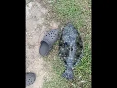
uploaded by: Flounder pounder

uploaded by: Stephen Spencer

uploaded by: Jon “Kuse”

uploaded by: Elzen Harris

uploaded by: RAMason69

uploaded by: Steven Butcheck

uploaded by: Joey Piercefield

uploaded by: Hoza

uploaded by: John Matthews
Designer Architect Richard Neutra
Best Fishing Spots in the greater Guam Government House area
Wharf's or Jetties are good places to wet a line and meet other fishermen. They often produce a fresh feed of fish and are also great to catch bait fish. As they are often well lit, they also provide a good opportunity for night fishing. There are 14 wharf(s) in this area.
USN Wharf A - 10km , USN Wharf B - 10km , USN Wharf R - 10km , USN Wharf S - 10km , USN Wharf X - 10km , USN Wharf L - 10km , USN Wharf M - 10km , USN Wharf N - 10km , USN Wharf O - 10km , USN Wharf P - 10km , USN Wharf Q - 10km , USN Wharf T - 11km , USN Wharf U - 11km , USN Wharf V - 11km
Beaches and Bays are ideal places for land-based fishing. If the beach is shallow and the water is clear then twilight times are usually the best times, especially when they coincide with a major or minor fishing time. Often the points on either side of a beach are the best spots. Or if the beach is large then look for irregularities in the breaking waves, indicating sandbanks and holes. We found 23 beaches and bays in this area.
Trinchera Beach - 2km , Hagåtña Bay - 2km , Dungcas Beach - 3km , Asan Bay - 4km , Piti Bay - 6km , Ypao Beach - 6km , Tumon Bay - 7km , Naton Beach - 7km , Pago Bay - 7km , Tagachan Beach - 8km , Gongna Beach - 8km , Sasa Bay - coral reef filled - 8km , Ylig Bay - 9km , Outhouse Beach - 10km , NCS Beach - 10km , Tanguisson Beach - 11km , Family Beach - 11km , Togcha Bay - 12km , Gabgab Beach - 12km , Dadi Beach - 12km , Rizal Beach - 12km , Salinas Beach - 13km , Tipalao Bay - 13km
Harbours and Marinas can often times be productive fishing spots for land based fishing as their sheltered environment attracts a wide variety of bait fish. Similar to river mouths, harbour entrances are also great places to fish as lots of fish will move in and out with the rising and falling tides. There are 8 main harbours in this area.
Gregorio D. Perez Marina - 1km, Aquaworld Marina - 7km, Harbor of Refuge - 7km, Marianas Yacht Club - 9km, Apra Inner Harbor - restricted Naval Base Guam - 9km, Jose D. Leon Guerrero Commercial Port - 9km, Apra Outer Harbor - 11km, Sumay Yacht Club - DoD restricted - 11km
We found a total of 100 potential fishing spots nearby Guam Government House. Below you can find them organized on a map. Points, Headlands, Reefs, Islands, Channels, etc can all be productive fishing spots. As these are user submitted spots, there might be some errors in the exact location. You also need to cross check local fishing regulations. Some of the spots might be in or around marine reserves or other locations that cannot be fished. If you click on a location marker it will bring up some details and a quick link to google search, satellite maps and fishing times. Tip: Click/Tap on a new area to load more fishing spots.
Gregorio D. Perez Marina - 1km , Municipal Tripoint Hagatna - Mongmong - Sinajana - 1km , Municipal Tripoint Agana Heights - Hagatna - Sinajana - 1km , Trinchera Beach - 2km , Hagåtña Bay - 2km , Guam Island - 2km , Adelup Point - 2km , Municipal Tripoint Asan - Agana Heights - Chalan Pago - 2km , Chaot River Municipal Tripoint Agana Heights - Sinajana - Chalan Pago - 2km , Cliff Top Municipal Tripoint Hagatna - Tamuning - Mongmong - 2km , Fonte River Asan-Hagatna Bridge - 2km , Fonte River Municipal Tripoint Asan - Hagatna - Agana Heights - 2km , Alupat Island - 3km , Dungcas Beach - 3km , Municipal Tripoint Sinajana - Mongmong - Chalan Pago - 3km , Municipal Tripoint Barrigada - Tamuning - Mongmong - 3km , Fonte River Dam - USN built 1910 - 3km , Oka Point - 4km , Asan Bay - 4km , Lonfit River Municipal Tripoint Yona - Asan - Chalan Pago - 4km , Municipal Tripoint Mongmong - Mangilao - Chalan Pago - 4km , Municipal Tripoint Mongmong - Barrigada - Mangilao - 4km , Saupon Point - 5km , Ypao Point - 5km , Asan Point - 5km , Matgue River Piti-Asan Bridge - 5km , Piti Bay - 6km , Ypao Beach - 6km , Leo Palace Lake - 6km , Chachao Municipal Tripoint Asan - Yona - Piti - 6km , Pago River Yona - Chalan Pago-Ordot Bridge - 6km , Piti Canal - 7km , Taogam Point - 7km , Tumon Bay - 7km , Naton Beach - 7km , Pago Bay - 7km , Aquaworld Marina - 7km , Harbor of Refuge - 7km , Tagachan Beach - 8km , Pago Point - 8km , Cape Iates - 8km , Gongna Beach - 8km , Bijia Point - 8km , Cabras Island - 8km , Sasa Bay - coral reef filled - 8km , Municipal Tripoint Dededo - Barrigada - Tamuning - 8km , Polaris Point - 9km , Tagachang Point - 9km , Ylig Bay - 9km , Ylig Bridge - 9km , Marianas Yacht Club - 9km , Apra Inner Harbor - restricted Naval Base Guam - 9km , Amantes Point - 9km , Fadian Point - 9km , Jose D. Leon Guerrero Commercial Port - 9km , Atantano River Piti-Santa Rita Bridge - 9km , Outhouse Beach - 10km , USN Wharf A - 10km , Apra New Inner Harbor Channel WW2 - 10km , USN Wharf B - 10km , USN Wharf R - 10km , USN Wharf S - 10km , USN Wharf X - 10km , Ylig Point - 10km , NCS Beach - 10km , 1st Leg Glass Breakwater - USN built 1941 - 10km , USN Wharf L - 10km , USN Wharf M - 10km , USN Wharf N - 10km , USN Wharf O - 10km , USN Wharf P - 10km , USN Wharf Q - 10km , Municipal Tripoint Barrigada - Dededo - Mangilao - 10km , Taguan Point - 11km , Tanguisson Beach - 11km , Tanguisson Point - 11km , Togcha Point - 11km , USN Wharf T - 11km , USN Wharf U - 11km , USN Wharf V - 11km , Family Beach - 11km , Apra Outer Harbor - 11km , Blasted Reef Boat Channel pre-WW2 - 11km , Fleet Landing Channel - US Blasted 1944 - 11km , Sumay Yacht Club - DoD restricted - 11km , Pelagi Islets - 12km , Tartuguan Point - 12km , Togcha Bay - 12km , Mahlac River Municipal Tripoint Yona - Talafofo - Santa Rita - 12km , Hilaan Point - 12km , Gabgab Beach - 12km , Dadi Beach - 12km , Apaca Point - 12km , Rizal Beach - 12km , The Lost Pond - 12km , Togcha Yona-Talofofo Bridge - 12km , Namo River Agat-Santa Rita Bridge - 12km , Salinas Beach - 13km , Tantapalo Point - 13km , Tipalao Bay - 13km
Comments